


In the last few years, Raba Kistner has been contracted to provide annual wetland mitigation monitoring and reporting to the U.S. Army Corps of Engineers (USACE) as part of South Padre Island Economic Development Corporation’s proposed Marine Science Center. We were requested to assist due to demonstrated expertise on a separate local coastal permitting project. The project is located in a sensitive ecological setting in the Lower Laguna Madre of South Texas.
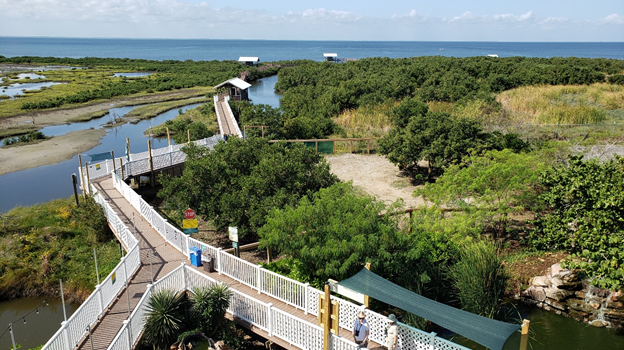
The client secured a permit from the USACE to fill a wetland on the property to accommodate the future public venue. As a condition of the permit, the client was required to construct wetland mitigation along existing boardwalks at the adjacent South Padre Island Birding and Nature Center. A wetlands mitigation plan was required and called for modifying a nearby site, removing invasive species, establishing a native black mangrove habitat, and improving the flow of tidal waters into the area to improve the estuarine environment. Raba Kistner was contracted to perform annual monitoring to help ensure the success of the approved mitigation plan.
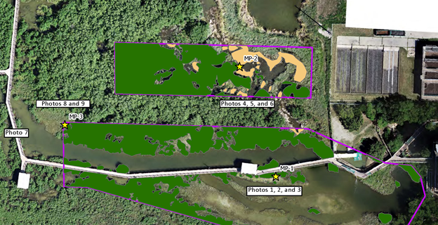
During our initial field visit, our scientists established multiple monitoring points, from which general observations would be made during annual visits.
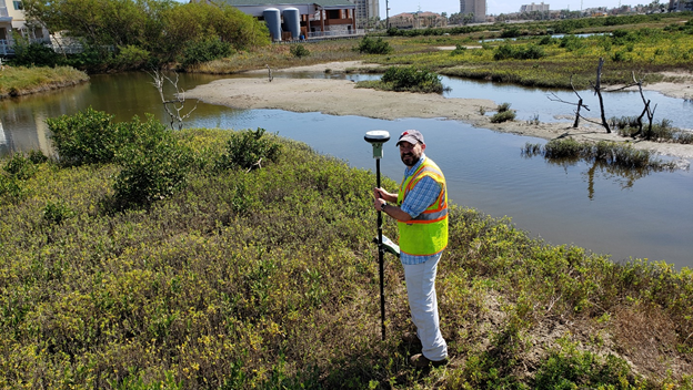
Annual monitoring events are conducted to identify whether specific mitigation success criteria are being met, and whether any corrective actions are needed (e.g. supplemental plantings, additional targeted invasive plant eradication, etc.) to bring the mitigation into compliance. As part of this task, our scientists perform on-the-ground habitat assessments, collecting field data and detailed photographs of site conditions.
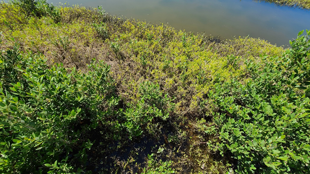
The client also conducts routine eradication of invasive cattails throughout the year to allow for more desirable species to flourish, and to prevent the cattails from inhibiting the flow of tidal water into and out of the mitigation area.
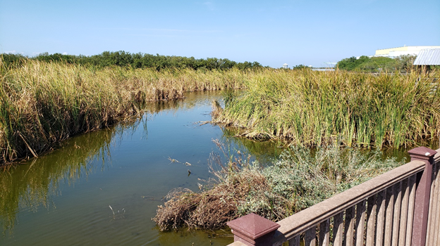
During annual site visits, our scientists record information regarding the establishment of desired plants and invasive species, and use this information to report on the overall progress of the mitigation project.
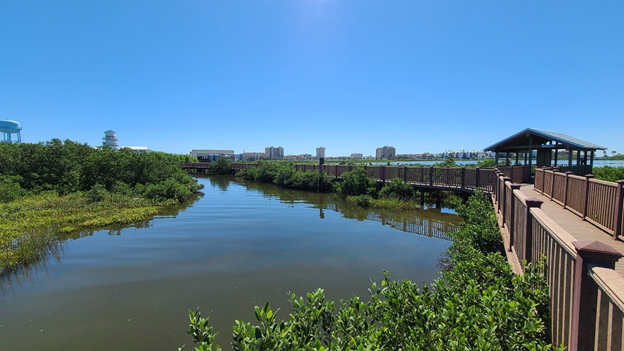
During each visit, our FAA Part 107 licensed drone pilots capture a seamless, high-resolution aerial of the current site conditions, which our GIS experts use to create clear exhibits showing major habitat types within the mitigation area.
After the annual mitigation monitoring commitment has been fulfilled (five years from the date the mitigation project was completed), the client will be released of its federal permit obligations, and a thriving native ecosystem will have been established. Raba Kistner is honored to provide professional scientific services on this unique project that will benefit the community of South Padre Island and its many annual visitors.